
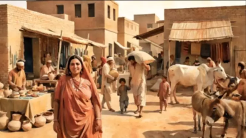
The Dawn of the Indus Valley Civilisation
The Indus Valley Civilisation, one of the world's earliest urban cultures, began with the Early Harappan phase from 3200 to 2800 BC. This period marked the emergence of fortified settlements, early trade networks, and distinctive pottery styles such as Amri-Nal, Kot Diji, and Sothi-Siswal. The Mature Harappan phase, spanning 2600 to 1900 BC, includes the iconic city of Mohenjo-Daro, often called the Pearl of the Indus Valley Civilisation.
Key Archaeological Sites of the Early Phase
Numerous sites across South Asia provide evidence of this ancient civilisation's spread and development. Bhirrana in Haryana, India, dates back to an astonishing 7570 BC, while Mehrgarh in Sibi-Balochistan, Pakistan, originated around 7000 BC. Other significant locations include Rakhigarhi in Haryana (6500 BC), Lothal in Gujarat (3700 BC), Amri in Sindh (3600 BC), Kalibangan in Rajasthan (3500 BC), Kot Diji in Sindh (3300 BC), Dholavira in Gujarat (3000 BC), and Banawali in Haryana (2500 BC).
These settlements showcase early architectural innovations, such as mud brick houses, fortified walls, brick dockyards, ploughed fields, and fire altars. The discovery of Early Indus Writing at Harappa, dating from 3300 to 2800 BC, highlights the civilisation's advanced communication systems.

Mohenjo-Daro in Global Historical Context
When Mohenjo-Daro was founded around 2500 BC, it existed alongside flourishing cities in Mesopotamia, including Ur, Uruk, Eridu, Larsa, Lagash, Nippur, Kish, and Mari. Concurrently, during Egypt's Age of the Pyramids, important cities like Memphis, Hierakonopolis (Nekhen), Abydos, Elephantine, and Heliopolis thrived, illustrating the interconnectedness of ancient civilisations.
Geographical Features Surrounding Mohenjo-Daro
The strategic location of Mohenjo-Daro was carefully chosen on elevated ground and artificial platforms to mitigate frequent floods from the River Indus, which created a fertile, alluvial plain. This river served as a lifeline for agriculture, livestock rearing, and fishing. To the west, the Khirthar Range, a 190-mile mountain system reaching 7,430 feet, formed a natural boundary between Sindh and Balochistan, stretching from the Mula River and Bolan Pass in the north to the Arabian Sea in the south.
The Bolan Pass, an 89 km natural valley, has historically been a crucial trade, migration, and invasion route linking the Indus Valley with Afghanistan, Iran, and Central Asia. These mountains provided protection from northern and western invasions, primarily composed of sedimentary rock. To the east and southeast, the Thar Desert, also known as the Great Indian Desert, covers 264,091 sq km and has yielded several Indus Valley Civilisation sites, including the 2025 discovery of Ratadiya Ri Dheri in Jaisalmer, Gujarat, India.
The southern boundary of Sindh along the Arabian Sea features a coastline of 270 to 348 km, from the Hub River to Sir Creek, with ancient sea ports, coastal lagoons, and mangrove forests. Mohenjo-Daro was situated on Prasiane Island of the River Indus, a location described by the Greek ethnographer Megasthenes in his work Indica around 350-290 BC.
Historical Accounts and Interpretations
Megasthenes, born in Asia Minor (modern-day Turkey), served as an ambassador to Chandragupta Maurya and provided detailed descriptions of India's geography, including Prasiane Island. He noted the Indus River, called Sindus by locals, formed large islands like Prasiane and Patale. Historical records from Arrian of Nicomedia and Quintus Curtius Rufus mention campaigns by Alexander the Great against Oxykanos (or Porticanus), a ruler in the region, with his capital possibly at Mahorta near Larkana.
Scholars like HT Lambrick and MH Panhwar have linked these accounts to modern locations, suggesting Oxykanos might relate to the Ucha Channa tribe in Sindh and Balochistan. Ancient cartography by Claudius Ptolemy references towns like Piska and Pardabathra near the Indus, with some identifying Piska as Mohenjo-Daro and Pardabathra as Badeh Bothra, 12 km west of the archaeological site.

Fluvial Geomorphology and Ancient River Courses
Research by Lous Flam and others outlines six major Post-Pleistocene river remnants in the Lower Indus Basin, including the Kandhkot, Jacobabad, Shahdadkot, Warah, Khairpur, and present-day Indus courses. The Warah Course, part of the Sindh Hollow, was a significant route, with Ibn Battuta describing the town of Janani (Junani) along it in 1333 AD. This area, rich in Islamic heritage, includes a school, mosque, and library with rare manuscripts.
Historical texts like Tareekh-e-Masoomi and accounts by Sir Henry Pottinger detail river systems such as the Sirwah and Ghar Wah, highlighting the region's agricultural and trade importance. Surveys by RD Banerji in the early 20th century identified 18 old beds of the River Indus between Mohenjo-Daro and the Khirthar Range, underscoring the dynamic landscape.
Ancient Trade Routes and Archaeological Discovery
Old trade routes, documented in 19th-century records, connected Karachi to Shikarpur and Sukkur via areas west of Manchhar Lake and Larkana. These routes, such as Route No. XVI and XVIII, passed through key settlements like Nasirabad, Khairpur Juso, and Larkana, featuring wells, pools, and fortified mud structures. The first reference to Mohenjo-Daro in a Survey of India map from 1856-64 called it Mayhun Jo Bohun, meaning the mound of over-burnt bricks, with surrounding villages like Vukro and Hassun Wahun still existing today.
This comprehensive exploration reveals the Indus Valley Civilisation's profound legacy, from its early settlements to Mohenjo-Daro's strategic and cultural significance, enriched by historical narratives and geographical insights.